Mapping the Human Layer of the Planet

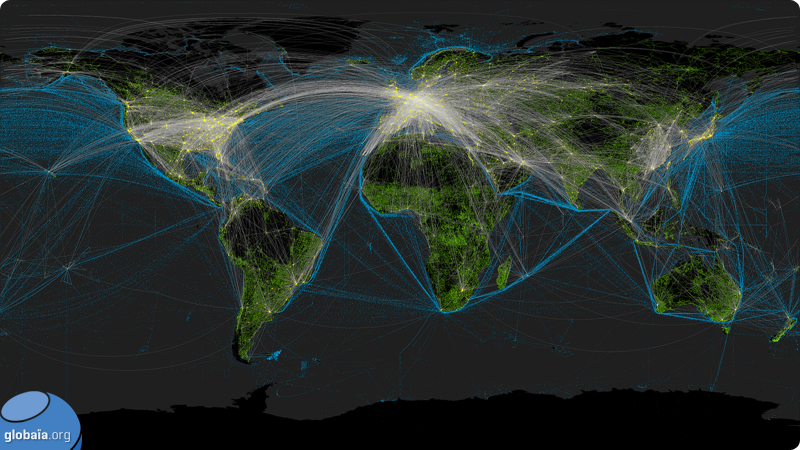
This concept illustrates and groups together the main agents that shape our planet, who literally engrave its surface—it is the anthroposphere, the human layer that grows inside the biosphere. This page is dedicated to the impressionist mapping of the artifacts from this singular moment in Earth's history. Impressionist because these maps are unlabelled and silent, giving free rein to contemplation and imagination; impressionist also because they do not follow the canons of cartography, where scales and legend are mandatory.
By locating the structures and hotspots of human activity, by acknowledging the extent of our footprints and our facilities, perhaps we will glimpse the limits of our world and the importance of redefining what it means to live in and on it. _Globaiavia_inhabitat
Anthropocene Mapping from Globaïa on Vimeo.
Labels: maps
posted by al fin at 9:37 PM
![]()
![]()

0 Comments:
Post a Comment
<< Home